At Contour Mapping Pros, we specialize in precision mapping and construction data solutions. Our expertise in drone technology and advanced modeling ensures reliable, innovative, and tailored results for your project.
Contour Mapping Pros brings over 5 years of expertise to deliver precision and actionable insights. We combine cutting-edge technology with an expert team to ensure your projects succeed from planning to completion.
Whether you’re optimizing a construction site, managing real estate development, or conducting environmental analysis, our scalable services adapt to your requirements.
Our accurate mapping and detailed visualizations empower you to make informed decisions. From terrain models to progress photos, every deliverable is designed to enhance communication and streamline project workflows
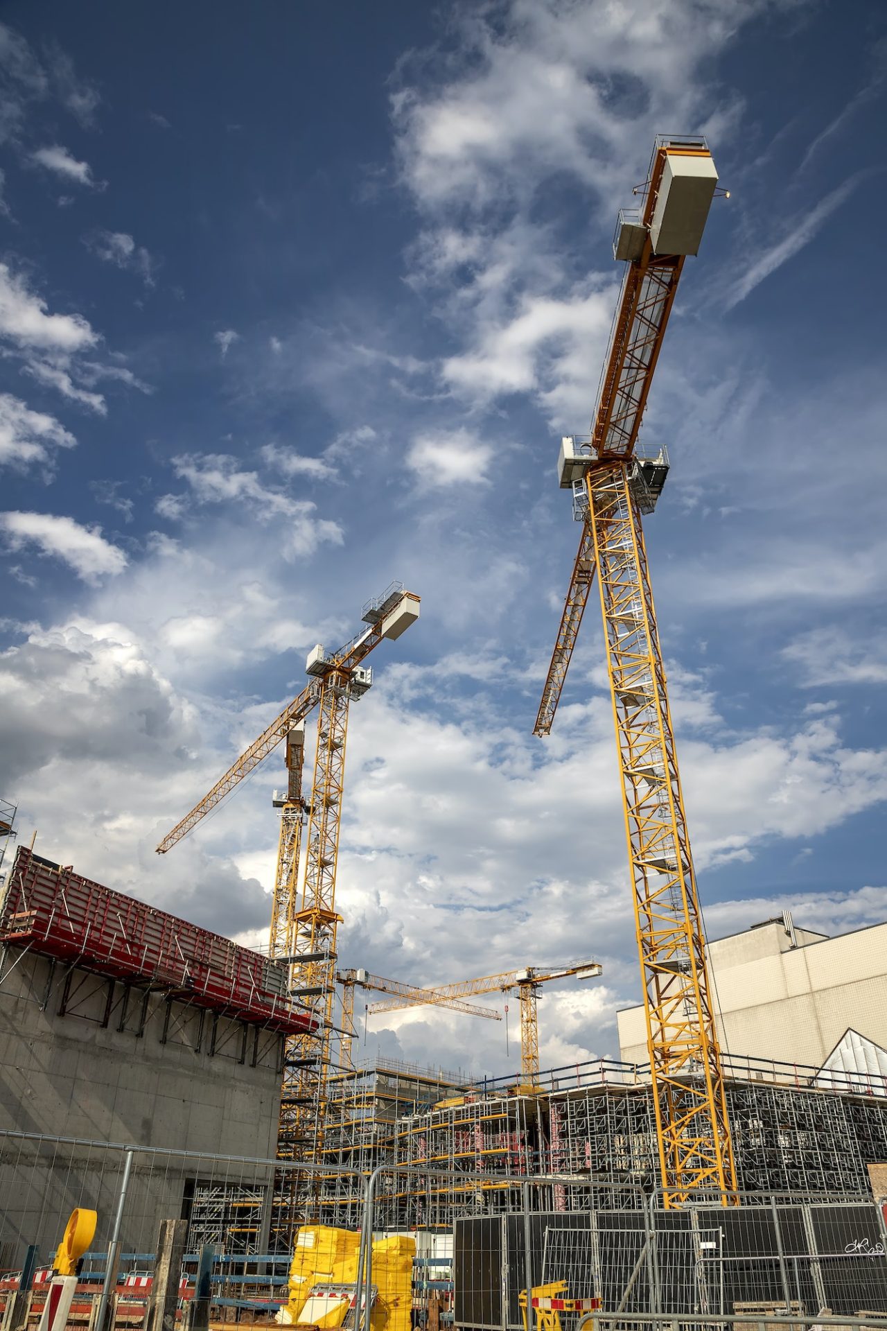
We offer a wide range of professional services designed to support and enhance your construction projects from start to finish. With a focus on precision, innovation, and efficiency, our solutions are tailored to meet the unique needs of each client. From detailed mapping and modeling to progress tracking and visual documentation, we leverage advanced technology to deliver exceptional results.
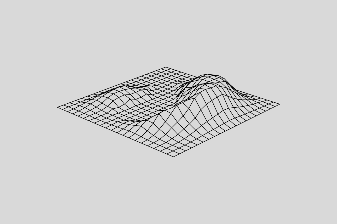
Our construction mapping and modeling services provide detailed 2D and 3D visualizations to enhance site design, planning, and project tracking. By leveraging advanced drone technology and cutting-edge software, we deliver accurate and high-resolution models of your construction site.
Keep your team and stakeholders informed with our professional construction progress updates. We provide high-resolution orthomosaic mapping, LiDAR data, and 3D models that document each stage of your project, offering a comprehensive geospatial timeline of the construction process. Our aerial data captures project milestones, tracks progress, and ensures accountability.
At Contour Mapping Pros, we deliver tailored mapping and documentation solutions designed to meet the unique challenges of various industries. Whether it’s construction, real estate, energy, or environmental management, our advanced drone technology and precision data empower businesses to optimize planning, enhance decision-making, and achieve their goals efficiently.
Streamline your projects with precise mapping, topographic data, and progress documentation tailored to meet the needs of construction managers and contractors.
Empower infrastructure planning with high-accuracy Digital Terrain Models, volume calculations, and geospatial data solutions.
Enhance project transparency with detailed site models, marketing visuals, and progress tracking for pre-sale developments.
Support sustainable decisions with accurate mapping for natural terrains, erosion monitoring, and land-use planning.
Optimize design and monitoring of pipelines, solar farms, and wind projects with advanced mapping and vegetation analysis.
Aenean pulvinar platea leo amet ligula vehicula quisque ridiculus ultricies quis.
At Contour Mapping Pros, we combine innovation, precision, and a client-centric approach to deliver exceptional results. Our team is dedicated to providing the most advanced and reliable mapping solutions to meet your construction, real estate, engineering, and environmental needs.
We leverage advanced LiDAR mapping, topographic data collection, and 3D modeling to ensure highly accurate and reliable results tailored to your project’s needs.
Whether it's a small site or a large-scale development, our services are adaptable and scalable, offering seamless integration as your project evolves.
With years of specialized experience in construction mapping, progress documentation, and geospatial data visualization, we deliver high-quality solutions for your most complex challenges.
Our drone mapping services offer exceptional accuracy, often comparable to traditional methods, with the added benefit of faster data collection. We use state-of-the-art LiDAR and high-resolution RGB imagery to deliver precise, reliable data for your project needs.
We provide data in multiple formats, including but not limited to:
Absolutely! Our services are designed to scale with your project. Whether you need a small site scan or comprehensive mapping for a multi-phase construction project, we can adjust our solutions to fit your needs efficiently.
Yes! Our topographic data, construction progress documentation, and 3D models are ideal for ongoing project monitoring. We offer solutions that allow you to track changes over time, ensuring your project stays on schedule and within budget.
At Contour Mapping Pros, we specialize in precision mapping and construction data solutions.
Signup our newsletter to get update information, news & insight