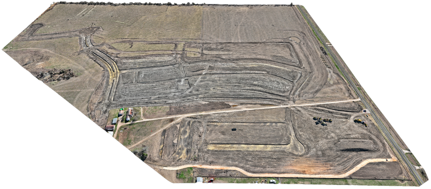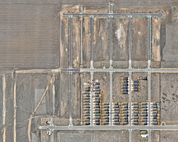
At Contour Mapping Pros, we provide industry-leading construction progress documentation to ensure your stakeholders stay informed and your projects remain on track. Utilizing advanced geospatial technology, we deliver high-resolution LiDAR scans, orthomosaic mapping, and immersive 3D models. These tools enable effective communication, detailed progress tracking, and enhanced project management with precise, data-driven insights.
At Contour Mapping Pros, we provide industry-leading construction progress documentation to ensure your stakeholders stay informed and your projects remain on track. Utilizing advanced technology, we deliver high-resolution LiDAR data, orthomosaic mapping, immersive 3D models, and impactful videos. These tools enable effective communication, detailed progress tracking, and enhanced project branding.
• Highly accurate elevation and terrain data for precise construction planning.
• Ideal for topographic mapping, earthwork analysis, and grading verification.
High-resolution, stitched aerial views that offer a detailed overview of your site. Ideal for layout visualization, early issue detection, and effective planning.
3D Interactive and detailed representations of your construction site, perfect for analyzing terrain, planning next phases, and showcasing progress.
Document your project’s progress with high-resolution LiDAR mapping, delivering unmatched accuracy and detail at every stage of development. Our LiDAR scans provide precise elevation data, terrain modeling, and volumetric analysis, ensuring every milestone is captured and effectively communicated to stakeholders. Whether for progress tracking, site analysis, or grading verification, our LiDAR mapping solutions are an essential tool for project management.
Track terrain changes and site development with high-precision elevation models.
Ensure accurate grading, volume calculations, and surface analysis for informed decision-making.
Provide stakeholders with comprehensive geospatial data, improving project transparency and planning.
Orthomosaics are meticulously stitched aerial images that provide a seamless, high-resolution view of your entire project site. Unlike traditional aerial photos, these images are geometrically corrected, ensuring accurate scale and representation of the land. This makes them an indispensable tool for project planning, monitoring, and analysis.
By offering a clear bird’s-eye perspective, orthomosaics empower teams to make informed decisions, identify potential challenges early, and track progress with unmatched clarity. From construction site layouts to environmental assessments, orthomosaics deliver the precision and detail required for effective project management.

Dive deeper into your project with interactive 3D models that provide a comprehensive representation of your construction site. These models are ideal for identifying terrain features, planning future phases, and presenting detailed updates to stakeholders.
At Contour Mapping Pros, we combine innovation, precision, and a client-centric approach to deliver exceptional results. Our team is dedicated to providing the most advanced and reliable mapping solutions to meet your construction, real estate, engineering, and environmental needs.
We leverage advanced LiDAR mapping, topographic data collection, and 3D modeling to ensure highly accurate and reliable results tailored to your project’s needs.
Whether it's a small site or a large-scale development, our services are adaptable and scalable, offering seamless integration as your project evolves.
With years of specialized experience in construction mapping, progress documentation, and geospatial data visualization, we deliver high-quality solutions for your most complex challenges.
Get started with comprehensive progress documentation tailored to your construction project.
512.504.6080
marcusg@flybyservices.com
street 1,2,3, California USA
At Contour Mapping Pros, we specialize in precision mapping and construction data solutions.
Signup our newsletter to get update information, news & insight