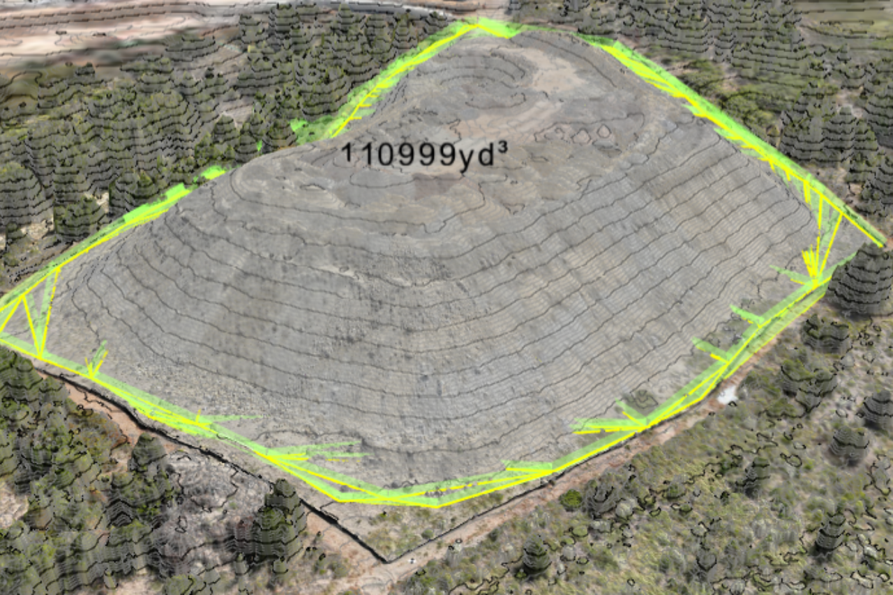
At Contour Mapping Pros, we deliver unparalleled topographic site mapping and volume calculations through advanced drone technology. Combining high-resolution RGB imagery and cutting-edge LiDAR data, our services provide the actionable insights required for efficient planning, precise design, and accurate progress tracking.
Elevate your site analysis with high-resolution LiDAR mapping, delivering unmatched precision for topographic surveys and quantity calculations. Our LiDAR technology provides accurate elevation data, terrain models, and volumetric analysis—essential for earthwork planning, cut-and-fill analysis, and grading verification.
Whether you’re assessing site conditions, planning excavation volumes, or preparing for construction, our advanced LiDAR mapping ensures you have the data you need for accurate, efficient project management.
Detailed elevation data for accurate cut-and-fill estimates.
Reliable data for material volumes and earthwork planning.
Ensure project grading aligns with design specifications.

We create Digital Terrain Models (DTMs) to represent bare-earth surfaces and Digital Surface Models (DSMs) to capture elevations of all features, such as buildings, vegetation, and other site elements. These datasets ensure a comprehensive view of your project site.

Utilizing a combination of LiDAR and RGB imagery, our drone mapping services produce highly precise elevation models and contour maps tailored to your specific project needs.

Our process is faster and more affordable than traditional surveying techniques, reducing field time while maintaining exceptional accuracy.

By merging RGB imagery with LiDAR data, we deliver layered insights and realistic visuals, enabling better decision-making and site analysis.
Our drone-based topographic mapping provides a range of applications to ensure your project’s success. Whether you’re in the planning phase or tracking progress, our data-driven solutions help you make informed decisions with confidence
Our accurate DTMs and DSMs support optimal design and preliminary site planning, helping you avoid costly errors.
Track changes in topography over time to ensure your project remains on schedule and within budget.
Precise cut-and-fill analyses streamline grading and excavation processes, saving both time and materials.
Accurately calculate material quantities for improved resource management and inventory tracking.
Understand site conditions with detailed DSMs that highlight vegetation heights, structural obstructions, and other features.
Our streamlined process ensures precision and efficiency in every project. We begin with state-of-the-art data collection, using drones equipped with LiDAR sensors and RGB cameras to capture high-resolution imagery and elevation data. This information is meticulously processed into Digital Terrain Models (DTMs), Digital Surface Models (DSMs), and other deliverables like contour maps, orthomosaics, and volume reports
We deploy drones equipped with LiDAR sensors and RGB cameras to collect high-resolution imagery and precise elevation data.
Using state-of-the-art geospatial software, we process data into:
We provide tailored outputs to suit your needs, including:
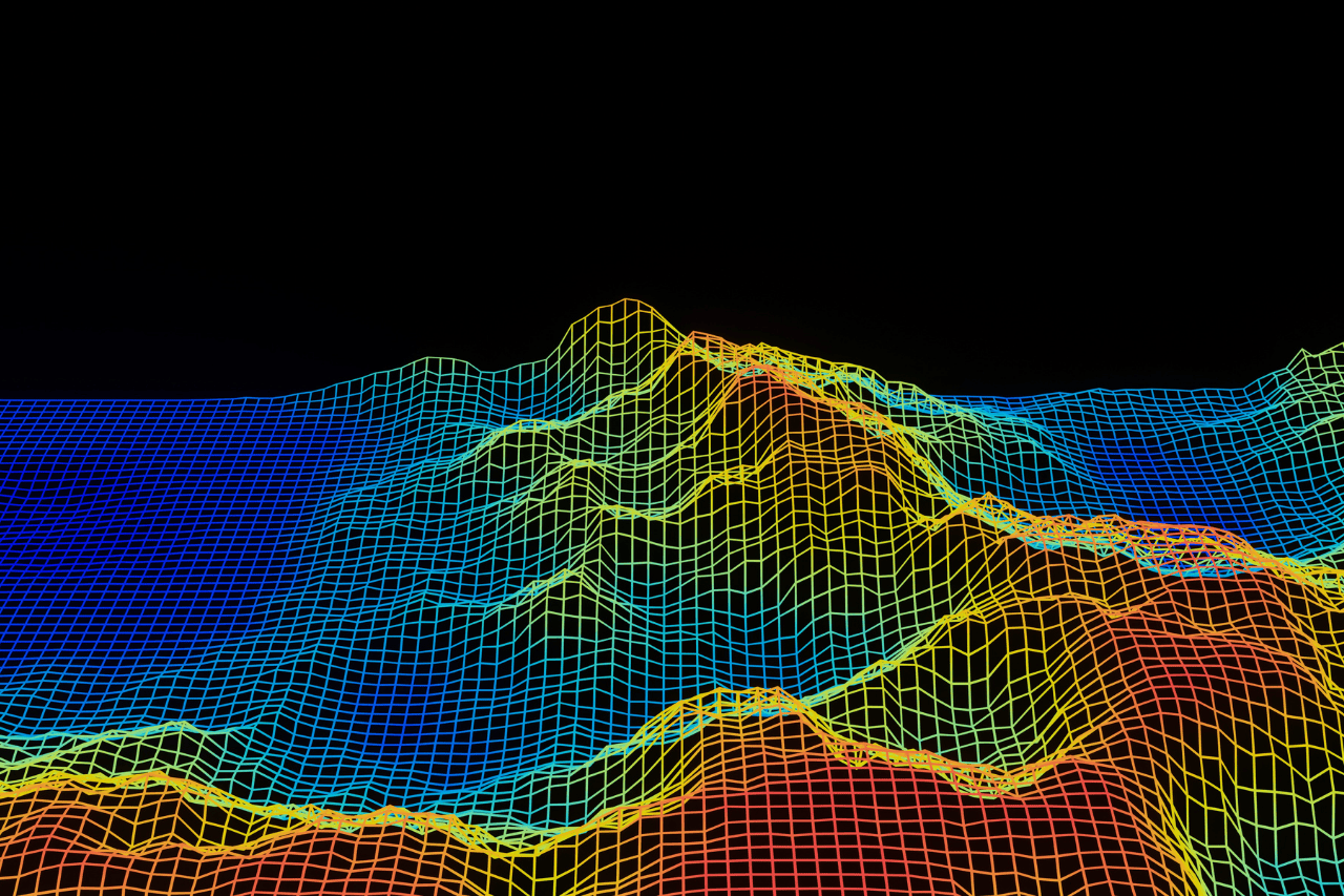
Digital Terrain Models (DTMs) and Digital Surface Models (DSMs) are essential tools for accurate site analysis and planning. DTMs focus on the natural terrain, making them ideal for earthwork, grading, and drainage design.
Ideal for analyzing natural terrain for earthwork, grading, and drainage planning.
Perfect for understanding surface-level features like vegetation, buildings, and obstructions.
Together, DTMs and DSMs deliver a complete picture of your site, enabling smarter planning and execution.
Contact us today to learn more about how our topo and quantity solutions can support your construction project.
512.504.6080
marcusg@flybyservices.com
street 1,2,3, California USA
At Contour Mapping Pros, we specialize in precision mapping and construction data solutions.
Signup our newsletter to get update information, news & insight